Lake Rotoiti
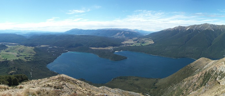
A substantial mountain lake within the borders of the Nelson Lakes National Park. The lake is fed by the Travers River, water from it flows into the Buller River. The greatest depth is 82 metres and it is surrounded by beech forest. Saint Arnaud is a small community at the northern end of the lake.
Tramping tracks circle the lake, including the Lakehead track on the east side and the Lakeside track on the west side of the lake. There is also a water taxi service that travels the length of the lake to ferry trampers to and from the Coldwater and Lakehead huts at the head of the lake. The lake is also a popular place for waterskiing and is adjacent to Mt Robert, which hosted a small club-owned skifield, until it was removed by DOC in 2005.
The lake has introduced trout which attract recreational fishermen.
Image: Panoramic view of Lake Rotoiti and the St Arnaud Range by Zoharby at Wikipedia.
Are you responsible for Lake Rotoiti?
You can claim this venue to manage this listing's details.
Past events at Lake Rotoiti
Log in / Sign up
Continuing confirms your acceptance of our terms of service.
Post a comment